The setup: Between work and dental appointment, I have had little chance to check weather all day on what I knew could be an interesting weather day. Finally home around 4:45 under clear sky with temperature in mind-90s, I check weather situation. As expected, best dynamics are to the north, but not as far north as I had thought likely. With surface low over northern Iowa with warm front across northern IL and trailing cold front to the SW from the low, an unseasonably strong combination of instability and shear was developing over eastern IA and MO and western IL. The 21Z RUC was predicting CAPE of 4000-6000 in west-central IL, and SRH of 200 - 400, with the higher helicity values farther north. Surface winds were from the SE, with fairly strong mid-level westerlies moving into the area. Something like a dryline was setting up over MO, with dewpoints in the mid to upper 70s along the Mississippi River in eastern MO and western IL (as well as much of IA), but only in the mid 60s in central MO, where the surface wind had shifted to the SW. All this made the area close to home in west-central IL look pretty good to me, but SPC was predicting the most action farther north, over much of IA and northwestern and north central IL. A possible negative was the cap that had largely prevented storm initiation so far. As I pondered the situation, I checked the SPC site once more and saw that a convective discussion had been issued for east central MO and central IL, in the areas with the above-described features. It noted that in some areas, CAPE had already reached 4000 - 6000, and that a tornado watch might be needed.
That was enough for me. I packed up and headed out, with a preliminary target between Carlinville and Jacksonville, IL. Some garden variety thunderstorms were moving across north central IL near the warm front, and I figured this general area was where the sort of dryline feature might overtake the ongoing storms - and I could get to this area with at least an hour of daylight remaining.
Out the door. Around 5:30, I headed up I-55 under a totally cloudless sky. After 25 miles or so I could see distant storm anvils to the WNW. I headed west through Carlinville on 108, then north toward Waverly on 111. Around 6:50, I get into range of SPI NOAA weather radio, and hear that a red box is out for all of central IL. The storms to my NW look very backsheared, and only when I get in the shadow of the anvil near Waverly can I make out any updrafts. It looks like the storms are not too far NW of Jacksonville, and they look multicellular. I head NW on 104 to Jacksonville, and see that the storms look quite strong but also outflow dominant, are in an E-W line, and that there are several distinct updrafts at the western end.
I am through Jacksonville and nearing the storms, now not far to my north, by around 7:20. Several counties around the area are under severe t-storm warnings. It is obvious that these storms are multicellular and outflow dominant, not quite what I was hoping for in the strong combination of shear and instability. The end of the line seems to be NW of Jacksonville - the storms look strongest N of Jacksonville (where wind damage was reported around 7:30), with a strong updraft visible just S or SW of the heaviest precip. I consider going that way, but having no good east or south option (except right back into town!) I figure I'll end up in the heavy precip with no visibility. So, I opt to head west for the end of the line hoping to see something in the updraft area. I can see there is a leading gust front with updrafts above, extending WSW from the cell north of Jacksonville, then more storms behind that. I elect to stay ahead of the gust front and flanking line above it, hoping to see something form in this area. Since the gust front marked the leading edge of the outflow, I thought it unlikely anything too interesting would develop in the storms farther north, unless I got well to the west of the western end of the leading gust front. But by the time I did that it would be dark, and going much farther west would put me in hilly country west of the IL River with limited eastward escapes. (According to the STL LSR, a couple brief tornadoes did occur in this area west of the river - the only ones reported with this storm complex, which produced mainly downburst winds.) From about 1 mile north of 104 on 1200E, I gradually drift SE to stay ahead of the gust front and the towers going up above it - but the northerly outflow keeps overtaking me and outruns the band of clouds above. The gust front and flanking line weaken as they move farther from the second line of storms to the N, and the storm just N. of Jacksonville has moved east. Now past 8:00, light is rapidly fading. There are some storms going up farther down the line to the WSW, but I don't figure I can get to them before dark.
I decide to return to Jacksonville, hit a drive-through, and work east along I- 72 toward I-55 and watch the storms to my north on the way home. By 8:40, I'm out of town heading east on I-72. At 8:55, the town takes a major hit from straight-line winds - trees and power lines down all over town and much of the town without power, according to news reports.. I watch frequent lightning in the squall line now just a few miles to my N, alligned east-west. There is a very low shelf cloud and some scuddy lowerings revealed by the lightning. T-storm warnings are up all along the line, and one county to my NE has a tornado warning for an imbedded supercell. The intense, linear storm activity just to my north continues as I proceed east, all the way to Springfield, and warnings are issued eastward. The western end of the line moved or built southward somewhat, so by the time I reached I-55, the storms are reported to have reached Waverly, WSW of Springfield and ESE of Jacksonville. As I head south on I-55, I see lots of CG 5 - 10 miles to my west.
I stopped at the rest area between Raymond and Farmersville and watched the lighting, which was now putting on the best display I had seen this year. It is lighting the NW sky almost continuously as the strongest storms move east just to the south of Springfield, producing both wind damage and hail to 1 inch south and southwest of Springfield. This lightning show made an otherwise less-than-successful chase a worthwhile one. By this point, the air is again warm and sticky and the inflow from the south is rushing toward the storm at 20 - 30 mph. Because the storm is again being fed directly from this inflow, it seems to reach a peak in intensity, at least as judged by the frequency of the lightning.
I head home, watching new storms develop just SE of the St. Louis area. I'm home about 10:10, total chase distance about 240 miles. A severe storm passes just S. of Edwardsville around 12:30, producing wind damage from Pontoon Beach to Troy. The main line, havng now built well to the S., enters the western suburbs of St. Louis after midnight, by which time the tornado watch has been replaced by a severe t-storm watch farther SE, but still including the St. Louis metro area, as the early red box had also.
Wind damage reports were very widespread over central IL and fairly widespread over east central MO. But as noted above, almost all the damage was associated with straight-line outflow winds.
LSRs associated with the line of storms I observed and with the later storms in the STL area are reproduced below. I may add a couple pictures later if they turn out, though I got very few due to the fact that it was getting close to dark by the time I intercepted the storms.
059
WWUS30 KSPI 130611
LSRSPI

PRELIMINARY LOCAL STORM REPORT...CORRECTED
NATIONAL WEATHER SERVICE LINCOLN IL
104 AM CDT FRI AUG 13 1999

TIME(CDT)  .....CITY LOCATION..... STATE   ...EVENT/REMARKS...
           ....COUNTY LOCATION....

0734 PM    2 N JACKSONVILLE          IL    WIND DAMAGE
08/12/99   MORGAN                          TREES BLOWN DOWN.  FROM
                                           SHERIFF.

0855 PM    JACKSONVILLE              IL    WIND DAMAGE
08/12/99   MORGAN                          WIDESPREAD WIND
                                           DAMAGE...TREES AND
                                           POWER LINES BLOWN DOWN.
                                           FROM CITY POLICE.

0900 PM    PLEASANT PLAINS           IL    WIND DAMAGE
08/12/99   SANGAMON                        POWER LINES DOWN. FROM
                                           ESDA.

1010 PM    AUBURN                    IL    60 MPH TSTM GUST
08/12/99   SANGAMON                        WIND DAMAGE ALSO
                                           REPORTED...UPROOTED
                                           TREES. FROM ESDA.

1015 PM    DIVERNON                  IL    .75 INCH HAIL
08/12/99   SANGAMON                        FROM ESDA.

1020 PM    PAWNEE                    IL    1 INCH HAIL
08/12/99   SANGAMON                        FROM ESDA.


028
WWUS30 KSTL 130652
LSRSTL

PRELIMINARY LOCAL STORM REPORT
NATIONAL WEATHER SERVICE ST LOUIS MO
153 AM CDT FRI AUG 13 1999

TIME(CDT)  .....CITY LOCATION..... STATE  ...EVENT/REMARKS...
           ....COUNTY LOCATION....

0802 PM    RIPLEY                    IL   TORNADO
08/12/99   BROWN                          ROOF BLOWN OFF HOUSE

0812 PM    COOPERSTOWN               IL   WIND DAMAGE
08/12/99   BROWN                          TREES AND POWER LINES
                                          DOWNED

0813 PM    CHAMBERSBURG              IL   TORNADO
08/12/99   PIKE                           BRIEF TOUCHDOWN IN AN OPEN
                                          FIELD

0815 PM    LA GRANGE                 IL   WIND DAMAGE
08/12/99   BROWN                          TREES AND POWER LINES
                                          DOWNED

1155 PM    WARRENTON                 MO   WIND DAMAGE
08/12/99   WARREN                         NUMEROUS TREES AND POWER
                                          LINES DOWNED

1200 AM    WRIGHT CITY               MO   WIND DAMAGE
08/13/99   WARREN                         NUMEROUS TREES AND POWER
                                          LINES DOWNED AND VEHICLE
                                          BLOWN IN DITCH

1212 AM    MOSCOW MILLS              MO   WIND DAMAGE
08/13/99   LINCOLN                        TREES AND POWER LINES
                                          DOWNED

1215 AM    FORISTELL                 MO   WIND DAMAGE
08/13/99   ST CHARLES                     SEVERAL TREES AND POWER
                                          LINES DOWNED

1220 AM    PONTOON BEACH             IL   WIND DAMAGE
08/13/99   MADISON                        TWO HOUSE TRAILERS DAMAGED

1230 AM    TROY                      IL   WIND DAMAGE
08/13/99   MADISON                        TREES AND POWER LINES
                                          DOWNED

1235 AM    ROSEDALE                  IL   WIND DAMAGE
08/13/99   JERSEY                         NUMEROUS TREES AND POWER
                                          LINES DOWNED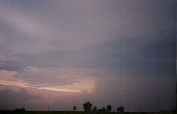