The Chase: I headed out at 4:45 p.m., north from Edwardsville on I-55. Around 5:30, I noticed some elevated showers to the north, probably around Springfield. At first I could only see the tops, which briefly looked impressive, but as I got closer I could see through the haze that they were elevated, localized, and it turned out, short-lived. Still, they were a sign of the instability in the air. As I approached Springfield the anvils of the real storms became increasingly visible to the NW. I decided to head west toward these storms, having heard a report on the Springfield weather radio that storms were moving through Schuyler Co. and would reach Morgan Co. by 6:00 p.m. I turned west on I-72 around 5:50; shortly thereafter the alarm started going off on the weather radio - but the first two times, the broadcast failed and no information followed the alarm. Perhaps this is an example of why the NWS, including the Lincoln office responsible for this weather radio station, is switching to an automated system. In any case, the third time, the announcement finally came through - a severe T-storm watch had been issued for all of central IL until midnight.
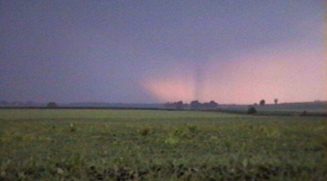
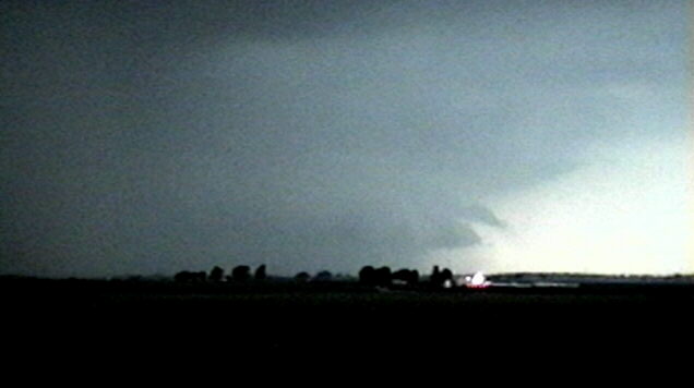
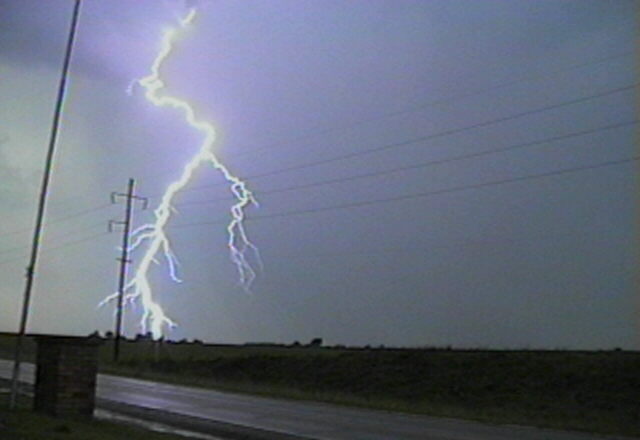
By 6:10, I could see very hard updraft towers under the very spread-out anvil of the storms ahead. In front of them I could see some kind of mid-level inflow structure, then total darkness toward the horizon. As I was heading straight for the storms from the downshear (east) side, and getting pretty close, I decided to exit I-72 at U.S. 67 just south of Jacksonville - about 6:30. Just as I was about to do this, the alarm went off again - a severe T-storm warning for my location (Morgan Co.) on the storm I was watching. Since the storm was directly to my west and the reported movement was to the east, I decided to try to work my way north of the storm - the updrafts appeared to be on the NW side of the storms. This way, I hoped I could get around the storm and get a better look at the RFB and the updraft area. I went west on the first local road off U.S. 67 to avoid town, went a mile west, then stopped to view the storm before turning north again. I stopped to take a few pictures and get a little video of the very dark rainshaft to my west, which ended abruptly on the north side of the storm, with a little RFB visible to the north. There was now lots of CG, and the storm was looking very impressive as it moved toward me. A very pronounced rainfoot had now developed at the north edge of the precipitation, with a very narrow new rainshaft forming just ahead of it. Here is a video still of these features. I worked my way gradually north and west to rejoin U.S. 67 at the SW edge of town, then followed 67 north at the west edge of town.
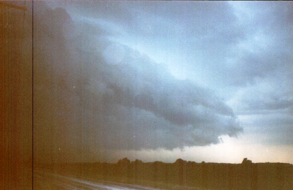
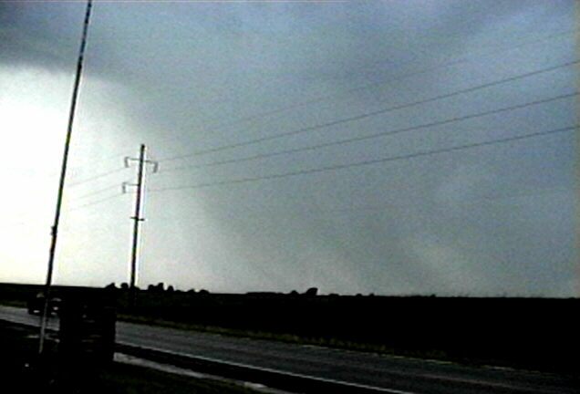
I stopped again to videotape and photograph around 6:40 at the NW edge of Jacksonville just before U.S. 67 turns from going N to going mostly W. The storm was now looking quite ominous, and soon a slight lowering appeared ahead of and north of the precip. At first I thought it might be a wall cloud forming; I could see clear northward movement along the front edge, which suggested the possibility of rotation. However, it quickly became evident that it was an arcus cloud, not a wall cloud; what I had briefly thought was rotation was in fact northward movement of the whole arcus cloud. The precipitation core extended to the southeast of this structure, and displayed a definite greenish color, with lots of CG. Clearly this had become a nasty storm, and evidently it was moving or spreading to the NE, not just to the east. If I was going to get around it, I would have to get farther north, which I attempted to do following back roads north of Jacksonville.
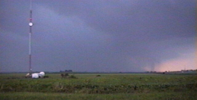
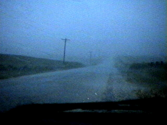
As I gradually worked my way north and a little east, it eventually became evident that I was not going to get around it. Given the road situation, outrunning it to the east didn't look like a good bet either, and even if I could, I wouldn't be able to get in position to see anything from that direction. Meanwhile, the arcus cloud raced to the northeast, with a very dark, impressive. curved structure filling the sky to the WNW, with its leading edge almost overhead. Around 7:00 I gave up all hope of getting around it, and found protected spot to pull off where the road was a little lower than the surrounding fields of tall corn (way more than knee high before the Fourth of July!), and where there were no trees or power poles upwind - and rode it out there, about 3 miles north of Jacksonville. Given the nature of the spot I was in and the fact that the storm was by now clearly outflow-dominant, I felt that this was the wisest and safest course of action. I was engulfed in blinding rain and high wind for about 20 minutes, 7:00 to 7:20 p.m. I would estimate the peak gusts at 50-60 mph, based on experience with past storms and the speed the sheets of rain were flying through the fields around me. Through the whole time the wind stayed SW or SSW, and there was lots of CG all around me. There was a little small hail briefly around 7:15.
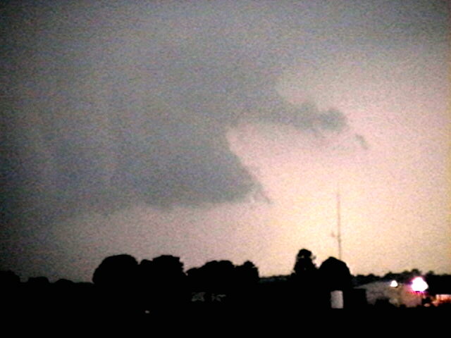
When the storm had let up by around 7:25, I headed back to Jacksonville to get something to eat. The first couple miles I saw some trees and branches down but cannot say for sure whether they were from this storm or previous ones. In town there were a few small branches down that were from this storm, but the main feature was runoff. I had to drive through 6 inches of water in the parking lot of the local Wendy's, and a trailer court across the street had some flooding. While I ate the sky cleared just enough to show that we were nearly surrounded by storms, with most of the sky except a small circle in the NW filled with anvil.
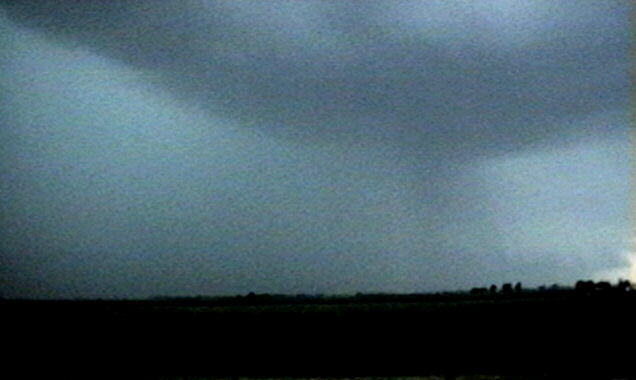
After eating, I drove a few miles NW of town on U.S. 67 and videotaped a new, non-severe, storm that was producing some impressive CG to the NW. The precipitation shafts appeared to be falling toward the NE - this storm seemed to be moving to the SE but the wind under it was still from the SW, leading to the very slanted rainshafts. To the SW was another storm that looked elevated and had a little CG - didn't look very impressive but I learned later that it did have a severe T-storm warning on it. I started home around 8:30 experiencing light showers and mostly distant lightning most of the way back to Edwardsville, following I-72 east to Springfield and I-55 south to Edwardsville.
Endnote: The storm I was on (and eventually in) appears to be the same storm that later blew down a tent in Petersburg, IL, about 20 miles to the northeast, around 8:00 p.m., causing 3 injuries. Although the reported movement of the storm was to the east, it actually moved to the ENE, as I observed from the time the first warning was issued until it moved over me a half hour or so later. The continuation of this direction of movement would have taken the storm right over Petersburg, consistent with the damage report and with the reported location of the storm (4 mi. SW of Petersburg at 7:45) when the another warning was issued for Petersburg (Menard Co). Here is the LSR for this and some of the other wind and damage reports from this storm. This and other storms continued east across central Illinois, causing 80 mph winds and considerable tree and power line damage over a wide area of central and east central Illinois.
Total chase distance: about 245 miles.
749
WWUS9 KMKC 282247
SEL2
MKC WW 282247
MOZ000-ILZ000-290500-

BULLETIN - IMMEDIATE BROADCAST REQUESTED
SEVERE THUNDERSTORM WATCH NUMBER 692
STORM PREDICTION CENTER NORMAN OK
547 PM CDT SUN JUN 28 1998

THE STORM PREDICTION CENTER HAS ISSUED A
SEVERE THUNDERSTORM WATCH FOR PORTIONS OF

CENTRAL AND NORTHEAST MISSOURI
CENTRAL AND SOUTHWEST ILLINOIS

EFFECTIVE THIS SUNDAY NIGHT FROM 615 PM UNTIL MIDNIGHT CDT.

HAIL TO 3 INCHES IN DIAMETER...THUNDERSTORM WIND GUSTS TO 80
MPH...AND DANGEROUS LIGHTNING ARE POSSIBLE IN THESE AREAS.

THE SEVERE THUNDERSTORM WATCH AREA IS ALONG AND 90 STATUTE MILES
EAST AND WEST OF A LINE FROM 45 MILES EAST SOUTHEAST OF JEFFERSON
CITY MISSOURI TO 20 MILES NORTHWEST OF BLOOMINGTON ILLINOIS.

REMEMBER...A SEVERE THUNDERSTORM WATCH MEANS CONDITIONS ARE
FAVORABLE FOR SEVERE THUNDERSTORMS IN AND CLOSE TO THE WATCH AREA.
PERSONS IN THESE AREAS SHOULD BE ON THE LOOKOUT FOR THREATENING
WEATHER CONDITIONS AND LISTEN FOR LATER STATEMENTS AND POSSIBLE
WARNINGS.

OTHER WATCH INFORMATION... CONTINUE...WW 691...

DISCUSSION...STORMS ARE ORGANIZING ALONG A BAND FROM NEAR QUINCY IL
TO NORTHWEST OF COLUMBIA MO. ACTIVITY IS LOCATED AHEAD OF WEAK
UPPER LEVEL DISTURBANCE MOVING EASTWARD TOWARD THE LOWER MISSOURI
RIVER VALLEY. AIR MASS OVER THE REGION IS VERY UNSTABLE WITH
LIFTED INDEX TO -10. SOUTHERN EDGE OF STRONGER WESTERLY MID LEVEL
FLOW EXTENDS ACROSS NORTHERN MISSOURI SUGGESTING SUFFICIENT DEEP
LAYER SHEAR TO ENHANCE SEVERE POTENTIAL OF STORMS.

AVIATION...A FEW SEVERE THUNDERSTORMS WITH HAIL SURFACE AND ALOFT
TO 3 INCHES. EXTREME TURBULENCE AND SURFACE WIND GUSTS TO 70
KNOTS. A FEW CUMULONIMBI WITH MAXIMUM TOPS TO 550. MEAN STORM
MOTION VECTOR 26025.

...WEISS

;382,0930 404,0905 404,0872 382,0894;


980
WUUS1 KSPI 282333
SVRSPI
ILC137-171-290015-

BULLETIN - IMMEDIATE BROADCAST REQUESTED
SEVERE THUNDERSTORM WARNING
NATIONAL WEATHER SERVICE LINCOLN IL
632 PM CDT SUN JUN 28 1998

THE NATIONAL WEATHER SERVICE IN LINCOLN HAS ISSUED A

* SEVERE THUNDERSTORM WARNING FOR...
MORGAN COUNTY IN CENTRAL ILLINOIS
SCOTT COUNTY IN WEST CENTRAL ILLINOIS

* UNTIL 715 PM CDT

* AT 629 PM CDT...LINCOLN DOPPLER RADAR INDICATED A SEVERE
THUNDERSTORM 7 MILES WEST OF WINCHESTER...MOVING EAST AT 20 MPH.

* THIS STORM IS EXPECTED TO AFFECT AREAS AROUND...
WINCHESTER
BLUFFS
JACKSONVILLE
MURRAYVILLE
FRANKLIN
WAVERLY

LARGE HAIL CAN BE EXPECTED WITH THIS STORM. GET INSIDE A STURDY
BUILDING AND STAY AWAY FROM WINDOWS.

REMEMBER...SEVERE THUNDERSTORMS MAY PRODUCE TORNADOES AT ANY TIME.

BYRD


386
WUUS1 KSPI 290048
SVRSPI
ILC129-290145-

BULLETIN - IMMEDIATE BROADCAST REQUESTED
SEVERE THUNDERSTORM WARNING
NATIONAL WEATHER SERVICE LINCOLN IL
748 PM CDT SUN JUN 28 1998

THE NATIONAL WEATHER SERVICE IN LINCOLN HAS ISSUED A

* SEVERE THUNDERSTORM WARNING FOR...
MENARD COUNTY IN CENTRAL ILLINOIS

* UNTIL 845 PM CDT

* AT 745 PM CDT...LINCOLN DOPPLER RADAR INDICATED A SEVERE
THUNDERSTORM 4 MILES SOUTHWEST OF PETERSBURG...MOVING EAST AT 30
MPH.

* THIS STORM IS EXPECTED TO AFFECT AREAS AROUND...
TALLULA
PETERSBURG
ATHENS
GREENVIEW
SWEETWATER

THIS STORM WILL PRODUCE DAMAGING WINDS AND LARGE HAIL. MOVE TO A
STURDY BUILDING AND STAY AWAY FROM WINDOWS.

REMEMBER...SEVERE THUNDERSTORMS MAY PRODUCE TORNADOES AT ANY TIME.

BYRD/AUTEN


0800 PM    PETERSBURG                IL    WIND DAMAGE
06/28/98   MENARD                          *** 3 INJ ***
                                           TENT BLOWN DOWN AT
                                           FAIRGROUNDS...CAUSING
                                           INJURIES. (ESDA)

0800 PM    1 N ATHENS                IL    WIND DAMAGE
06/28/98   MENARD                          TREES AND POWER LINES
                                           DOWN ON ATHENS BLACKTOP
                                           AND ALSO IN ATHENS.
                                           FROM CHANNEL 20 AND ESDA.

0810 PM    8 W WILLIAMSVILLE         IL    WIND DAMAGE
06/28/98   SANGAMON                        TREES BLOWN DOWN...SOME
                                           STRUCTURAL DAMAGE (ESDA)

0815 PM    SAN JOSE                  IL    60 MPH TSTM GUST
06/28/98   MASON                           (ESDA)

0815 PM    LINCOLN LOGAN CO ARPT     IL    79 MPH TSTM GUST MEASURED
06/28/98   LOGAN                           AT THE LINCOLN NWS
                                           OFFICE.

0815 PM    LINCOLN                   IL    NUMEROUS TREES AND POWER
06/28/98   LOGAN                           LINES DOWN IN TOWN OF
                                           LINCOLN. NUMEROUS 2 FOOT
                                           DIAMETER TREES FELL ON
                                           HOMES. 1/2 OF CITY WITHOUT
                                           POWER. JEFFERSON STREET
                                           HAD MANY TREES ACROSS
                                           STREET. FROM COUNTY ESDA.

0815 PM    1 N BROADWELL             IL    WIND DAMAGE
06/28/98   LOGAN                           EQUIPMENT SHED DESTROYED.
                                           FROM ESDA.

0815 PM    LINCOLN                   IL    50 TO 100 OR MORE TREES DOWN
06/28/98   LOGAN                           ACROSS THE COUNTY.  ALL
                                           CITIES AND TOWNS IN COUNTY
                                           REPORTED TREES...POWER LINES
                                           OR TELEPHONE LINES DOWN.
                                           HARDEST HIT TOWNS WERE
                                           LINCOLN...LAWNDALE...
                                           BROADWELL AND CHESTNUT.
                                           ABOUT A DOZEN HOMES WITH
                                           TREES ON THEM OF 2 FOOT
                                           DIAMETER.
                                           FROM 0810 PM TO 0825 PM.
                                           FROM COUNTY ESDA.

0830 PM    1 W CLINTON               IL    WIND DAMAGE
06/28/98   DEWITT                          POWER LINES AND POLE DOWN
                                           ON ROUTE 54 WEST OF CLINTON.
                                           POWER POLE DOWN 4 W OF
                                           CLINTON. BETWEEN 0830 PM AND
                                           0845 PM. FROM ESDA.

Comments to jfarley@siue.edu