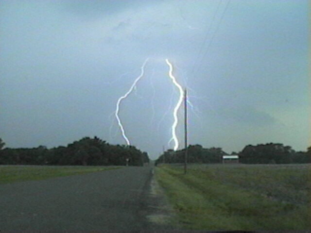
When I got to Hamel, I noticed another strong storm had developed just SE of Hamel. I proceeded north on the frontage road to I-55, watching both storms produce some small scuddy lowerings. Both were throwing down lots of CG. Gradually the eastern storm became the dominant one and drew my attention from then on. It was moving mostly to the north and seemed to be backbuilding a little to the NW. The wind blasted into it from the west - a combination of outflow from the western storm and inflow to the eastern one. I backed west to Worden, then angled a few miles north and west of there on section roads. The storm appeared very intense with lots of CG lightning and developed a bit of an arcus cloud along its northwest edge.
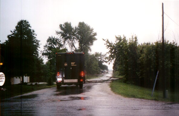
At 1:15 a SVR went up for this storm, indicated to have been observed on radar in a line from about 3 miles east of Edwardsville to Highland. (Actually by now it had moved several miles north of that location.) I watched and taped the CG show for a while, then worked my way home starting around 1:30 crossing behind the storm several times to look for damage. I saw a lot of small-to-medium size branches down, and a couple good-sized trees down in and west of Alhambra and between there and Marine. BTW, it is true that UPS is VERY determined to deliver your package - I saw a UPS driver trying to move an entire dead tree that had fallen and was blocking his delivery route in Alhambra! He got out to move the tree just after I took this picture! Also there was some big-time field flooding around that area.
These storms were two of many strong to severe pulse storms that went up around the St. Louis area that day. Other storms caused significant wind damage at malls in St. Peters, MO and Fairview Heights, IL, while yet another produced 1-inch hail that evening in Florissant, MO. We saw this storm off to the NW on the way to dinner in the evening; it looked quite impressive. None of these storms showed any rotation - shear was virtually non-existent - but with the very unstable airmass and high dewpoints, many of the storms were able to briefly pulse up to severe levels.