
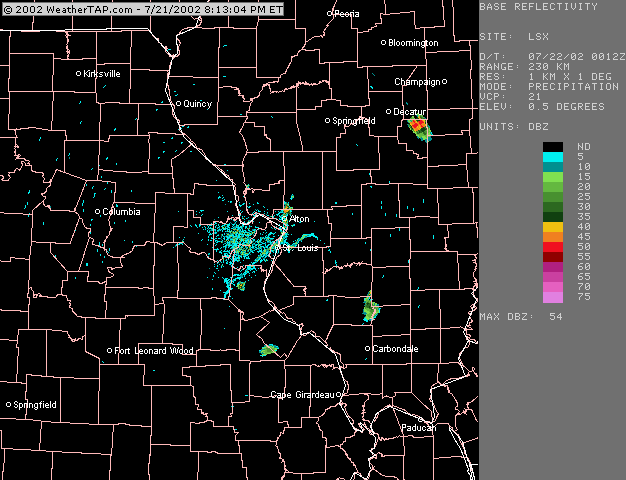
The last hour or so of this process can be seen in this radar loop from 7:12 - 8:05. The refineries are located just east of the bend in the Mississippi river northeast of St. Louis (below and just to the left of the "A" in Alton on the radar map). Note that there are two other areas of similar more or less stationary convection, one in Jefferson Co. south of St. Louis and another east of Decatur, IL. I do not know if there are any similar man-made features that may have contributed to convetion in these areas.
An interesting feature of the Wood River storms is that, while it may appear on the radar that the anvil and anvil precipitation blew off to the north, that is not what actually happened. What happened is that the storms' updrafts propagated northward, eventually weakening when they got far enough north of the refineries (in some cases, well into Macoupin County). That is what causes the northward motion in the radar loop. At one point, a weak outflow boundary can be seen in the loop moving northward from the forward edge of the storms in Macoupin County. The anvil, in fact, blew to the south, reflecting upper winds from the north while the lower level winds were from the south.
Another interesting feature that can be seen on the radar is a boundary (perhaps an outflow boundary from earlier convection to the south) that moves north through the St. Louis area during the loop. Toward the end of the loop this boundary moved over the refinery area, and it is at this time that the strongest cell formed.
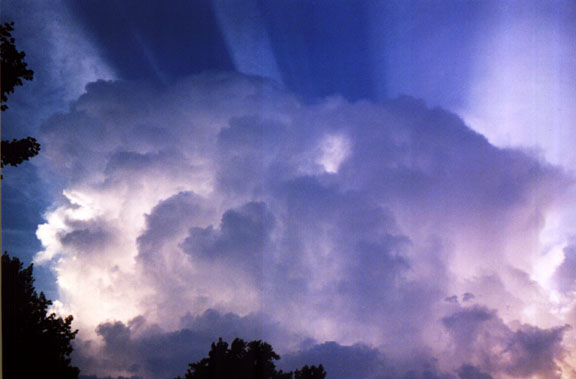
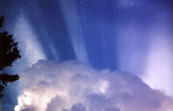
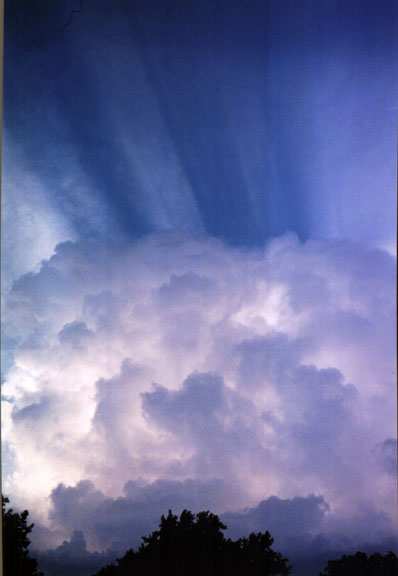
Finally, these storms were exceptionally photogenic from my home in Edwardsville, because they were directly between my location and the sun. They cast shadows over some cirrus debris from earlier convection, and the adjacent shadows and crespicular rays created spectacular arcs of light and shadow above the storms.