Transects of surface sediment samples were taken in 4 lakes from the Sylvania Wilderness Area, Upper Peninsula of Michigan. These surface samples were compared with diatom samples for a core taken in the Northwest basin of Crooked Lake, also from the Sylvania Wilderness Area. Weighted Averaging calibration was used to reconstruct lake depths in Crooked Lake using the diatom microfossils from the core and the surface samples to infer past lake depth. During the early Holocene the lake was dominated by plantonic species and diatom-inferred water depth was large (14m). At about 8,000 BP inferred water depth became shallow (2m) and samples were dominated by Fragilaria construens var. venter . -- a species characteristic of shallow parts of the surface sample transects. From 8,000 to 3,000 BP reconstructed water levels increase because of increasing abundance of Aulacoseira ambigua -- a planktonic species. modern water depth was reached about 3,000 BP.
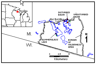
Location Map of Crooked Lake
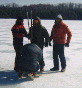
Coring at Crooked Lake