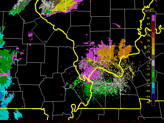
This next image from 2251Z (5:51 p.m. CDT) shows the couplet farther east, near Red Bud. At this time, a tornado was reported just east of Red Bud.
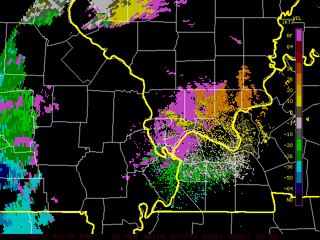
The next image from 2256Z (5:56 p.m. CDT) shows the couplet continuing to move east along the northern edge of Randolph Co., now clearly to the east of Red Bud.
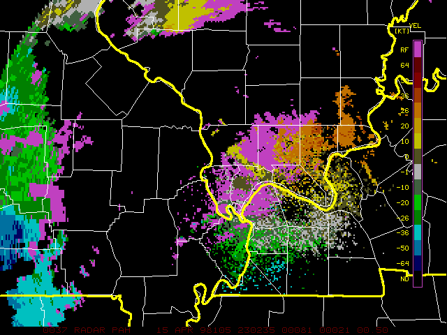
In this final image, the couplet is still farther east along the Randolph-St. Clair County boundary. These and other radar images indicate that this storm produced a persistent mesocyclone which moved east from near Lake of the Ozarks into southwest Illinois. The storm produced hail ranging in size from 1 inch to 4.5 inches in diameter, as well as several reports of tornado touchdowns including the two noted above.
I am grateful to Chris Novy for providing me with these radar images.