1:20 - Out the door; I headed north on I-55 from Edwardsville, IL.
2:20 - I encountered a heavy downpour just south of Springfield, associated with a curved N/S line of showers and thunderstorms from Peoria to S. of Springfield.
3:15-3:25 - I watched a strong elevated t-storm move over Bloomington-Normal. I saw a CG ahead, which knocked the radio station I was listening to off the air briefly.
3:30 - I stopped at the Wendys/Pilot in Bloomington (hwy 150 exit) to check TWC. (Chasers - a great place to check WX. It has a 25 cent-a-minute internet terminal, too.) The line of T-storms that had formed west of Dubuque had now produced severe wx in CHI area; it trailed to the WSW to about I-39 north of Bloomington, moving to the SE or ESE. I decided to continue on I-55 for intercept between Bloomington and Pontiac.
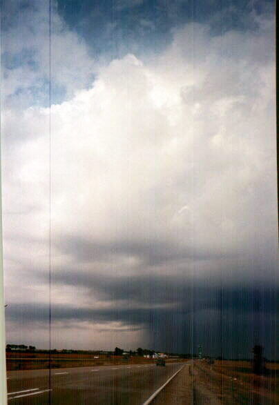
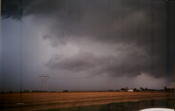
Around 4:00 - 4:30 - I exited I-55 at Chenoa, headed a little north on old Route 66, and parked and set up tripod on the closed side of old Route 66 just north of Chenoa as the tail-end storm approached. To the N and NE was a Shelf cloud, some lightning, and heavy rain. To the W and NW was a ragged updraft base with brief lowerings. This apparent inflow structure was one of the more interesting. After 20-30 minutes this part of the line went outflow-dominant, as new storms were forming farther west. I left, passed by a spotter/chaser just S. of where I had been, and worked my way west on U.S. 24 to U.S. 51, then worked my way northwest of El Paso on back roads.
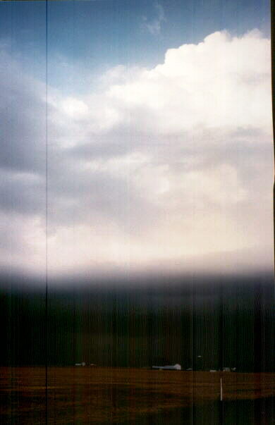
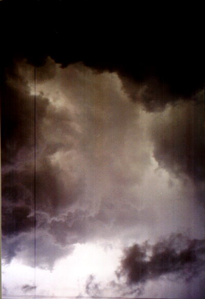
Around 5:00 - I was now getting close to the storm again, and saw that it was backbuilding rapidly westward. It looked like a solid line to my N, but I saw breaks in the precip under updrafts of cells in the line. One to north formed slight lowerings under an updraft, with heavy precip to its east. Lightning was now increasing rapidly. I passed two more spotters or chasers watching the storm, and stopped about 5 mi west of 51 on 1400 N (I think). I stopped to tape and photograph the storm; this cell moved to my east with another to its west. I followed the eastern cell back east to U.S. 51 where it almost overtook me as it moved SE - it was just north of the E-W road I was on. Scud caught in outflow was now moving SW under the cloud base which was moving to the SE. Strong inflow structure was evident just to my NE, with lots of CG. Then I noticed that the cloud base almost overhead was yellow-green - possibly from light being refracted through hail. But now, I was in outflow from N/NE and the storm was about to overtake me. I headed south on U.S. 51 to El Paso to get ahead of storm.
5:30 - 5:45 - I parked under I-39 on U.S. 24 facing west to watch new cell within a couple miles and rapidly-approaching from NW. (Note: this is at the west edge of El Paso and 24 here is not a high-speed road or expressway.) Lots of CG again. It looked like the strongest part of the cell was going to my SW so I started out into the rain from under freeway - then 1/4 to 1/2 inch hail started hitting. I returned quickly to other (eastbound) side of the underpass to get out of hail and was joined by others. After a few minutes the hail stopped, though fairly heavy rain continued, and I could see breaks to N. I started out again, but the hail resumed. I turned around and managed to get the last spot left under I-39 on westbound side of U.S. 24.
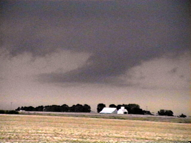
6:00 - That cell passed to the SE after a few more minutes, so I headed south on I-39 to get back ahead of the line. The line extended eastward and was backbuilding westward again. I got back ahead of the line, so it was again to my N. I could see a brief lowering under the updraft of a heavy cell on the line to my ENE, and exited at Hudson to observe it. The lowering quickly dissipated.
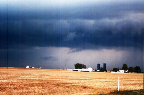
6:20 - 6:30 - After following I-39 south to I-55, I exited at I-74 westbound and took the first exit, which was a mile down 74, to stop and watch the storm again. It again showed the structure of a multi-cell line storm, with updrafts and occasional slight lowerings evident between areas of heavy precip, along with lots of scud. There was again lots of lighting, too. The heaviest cells with small hail were now reported just east of Peoria, acccording to NWR. I watched the approaching line of storms for 5-10 minutes in fading light, then headed on.
7:00 - I stopped to get gas and eat in Lincoln. Now, the backbuilding had stopped, and the tail-end storm was coming, approaching Lincoln from the NW. While I ate, the storm swept over, producing heavy rain and gusty (but non-severe) NE wind but no hail. Later, as I headed south from Lincoln to return home, the tail-end storm to my east produced lots of CG, but no additional backbuilding was noted.
9:00 - Home. Nothing really severe, but nice storm structure, quite a barrage of rain and small hail, and lots of CG. About as much as could be hoped for with this setup.
Total chase distance: 370 miles.
Comments to: jfarley@siue.edu
Return to John Farley's Weather Photos
Return to John Farley's Chase Reports Page