5:00 - Storms now clearly visible to NW; stop for quick carryout in Jerseyville. Here is a radar image from around this time showing the storms now crossing into Illinois.
5:30 - After passing through Carrolton, I see new hard, briefly overshooting towers ahead near the east end of the cluster of storms. I decide that rather than continuing to Winchester, I will stay on 67 as it curves to NNE toward Jacksonville, to stay ahead of storms.
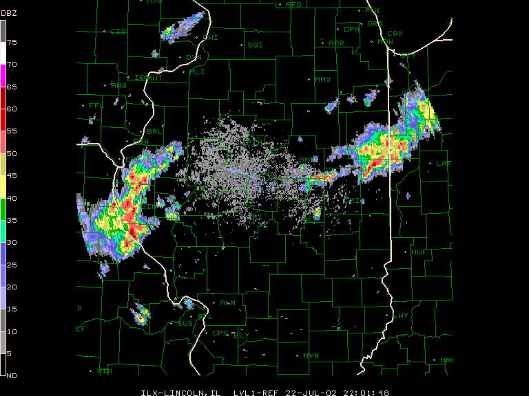
5:50 - In rapid-fire succession, SVR warnings are issued for NE Pike Co., then for Scott and Morgan Counties, then for Cass County, all for svr storms indicated by radar NW of Winchester and W of Jacksonville. Here is a radar image from just before 6 p.m. showing the storms just northwest of Winchester and Jacksonville.
Shortly after 6:00 - I am thinking I can cut west and then north of Jacksonville when I get to I-72. However, the storm has other ideas, and is surging eastward now quicker than I realized and quicker than the reported motion in the warnings. I see a shelf cloud to my west - impressive but fairly high-based, with a lot of scud underneath to my west and dense precip to my NW. Just as I get to I-72, a huge cloud of dust goes up and surges across 67 right at the freeway. Cars pull over, but I figure by getting on 72 and racing east I can get back ahead of it. Amid dust, twigs, leaves, and various light debris flying through the air, I blast east, and eventually get ahead of the storm. At the time I got on I-72, I would estimate the outflow wind at 50-60 mph. Big clouds of dust and surging precipitation are right on my tail.
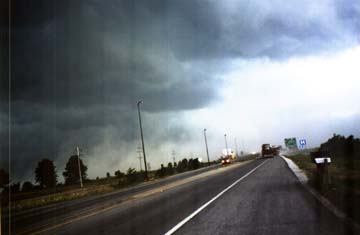
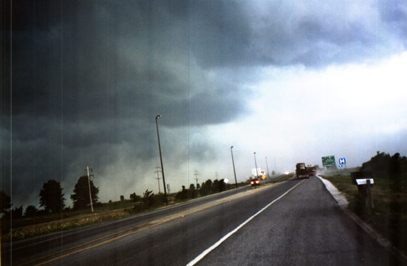
Around 6:15 or 6:30 (not sure of exact time), I stop at the first exit east of Jacksonville, quickly photograph the shelf cloud and some dust clouds under it, then blast east again as it hits me within a couple minutes.
This time I go a little longer, maybe 10 minutes, before stopping again at the next exit. I photograph more of the shelf and the blowing dust, then blast east again. As I an on the onramp, I notice something surging east to my right. I stop to take this picture - I don't know if this is dust that was blown up under the semi truck (hard to see) in the lower right of the picture where the cloud is originating, or if the truck had trouble and was emitting smoke or steam - but the smoke or dust raced east at a very high rate of speed.
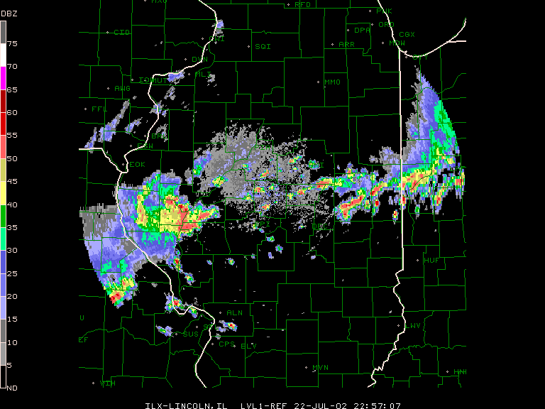
I make one more stop, and again photograph the approaching shelf cloud. The most intense part of the storm, which generates new warnings for Logan Co., is passing to the NW of Springfield, but strong winds continue to blow up dust plumes along the gust front extending south from the storm, still racing east along I-72. SPC issues an MCD updating information on the blue box, indicating potential for marginally severe storms with strong winds ahead of a Jacksonville to Danville line.
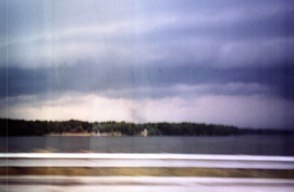
By little before 7, I'm heading south along I-55 to return home, hopefully getting ahead of a developing cell down the line. As I approach Lake Springfield, I see a new could of dust surge upward under the shelf cloud to the west. Since it is heading straight toward me as I'm blasting south on the freeway, I can't tell for sure if it's a dust plume like the others or a gustnado, though I think a dust plume is more likely what it was. Here is a photo of it looking west across Lake Springfield. (This is a little blurry because I took it on the fly through the closed car window.) Minutes later, when the gust front hit the lake, a sailboat was swamped near this location and a rescue of the two people on the boat was required.
Around 7:15 - I stop for 10 minutes or so at the Carlinville exit to photograph and videotape the approaching gust front. As it nears, a precip core intensifies rapidly just to my west, and I decide to drop south to avoid it. Shortly after 7:30, though I cannot avoid the next one as it crosses I-55 just south of Litchfield, and I am in blinding horizontal rain for about 5-10 miles - near zero vis at times.
Around 7:40 - I hear SVR warnings for parts of the STL area as I see an intense cell, with a large, hard updraft tower on its front flank to my south. Lots of lightning in this one, too. I arrive home a little before 8 as Madison Co goes under SVR. Shortly later, I try some lightning photography as the core passes just south of Edwardsville. Considerable wind damage in the STL area; 2 houses severely damaged by falling trees, and a house and a moble home destroyed by fires started by lightning. Just after the storms move through the metro area, SPC issues a new MCD indicating some, but lessening, potential for isolated severe storms as the line continues through southern IL.
Total chase distance: 184 miles.
Here are local storm reports from the Lincoln, IL NWS office.
Here are local storm reports from the St. Louis NWS office.