I headed out around 3:30 as storms began to form on the boundary S of STL on the MO side of the Mississippi River. As SPC was thinking in its discussion, I figured the storms would move/spread into IL south of the metro area, and I could intercept them rather easily. I headed east from Edwardsville on IL route 143, turning south on route 4 to intercept the storms in Randolph Co. As I neared Lebanon, I could see a hard tower to the SSW. Soon I could see there were lots of towers, with one overshooting just to my SSE. I could see there were multpile storms, but since I could only see the tops over the haze and scattered low clouds, I could not tell how many there were, figuring some of what appeared to be distinct storms might be old overshoots carried downwind by the strong upper wind fields.
After about an hour, I caught up with the storms near Sparta. There was one substantial elevated cell to my east, and I was in light rain which I presumed to be anvil rain from a storm somewhere to my west. Unfortunately, along and anywhere south of the storms, the sky was filled with low clouds, and I could see nothing. I figured my best bet was to be sure to get south of the storms, then try to approach them from the front side. I took route 150 southwest to Chester, passing through there a little before 5. There was increasing static on a.m. radio, and the sky to the NW seemed darker - but I could see no features whatsoever through the low cloud cover.
In Sparta, I tried to call Alice to check radar, but my cell phone did not work - got a message saying my number was unrecognized. Decided to poke north toward the darker skies and suddenly the clouds parted to reveal a rock hard tower just a mile or two ahead. By now I was on route 3 which follows the river bluffs NW out of Chester - very hilly with limited road options. I hoped to find an open spot and view the storm as it passed north of me, but open spots were hard to come by and I started hearing loud bonks as the large raindrops I had been in suddenly morphed into dime size hail, being flung out by the updraft now only about a mile to my NW. The hail rapidly intensified a mile or so north of the Chester Mental Health Center, so I made a quick U turn and retreated to watch the storm for the Mentah Health Center's parking lot and phone in the hail. LSX issued a SVR at 5:07 p.m., based on my report and radar indication of the severe storm, now a little NE of Chester. The storm did form a kind of rounded lowering right under the updraft for a few minutes, but that did not persist and showed no signs of rotation. This was the second of what turned out to be 3 times this week that I got pelted by severe hail in what looked like clear air just S or E of an updraft with the main precip core to the N, NW, or NE of my location. I had read about this phenomenon from other chasers but usually stay far enough from the updraft/meso to avoid it. Not this week! I figure the reason is that I have a new car I don't want hail dents in. So far I've been lucky, hail stayed just below the size that would have done real damage.
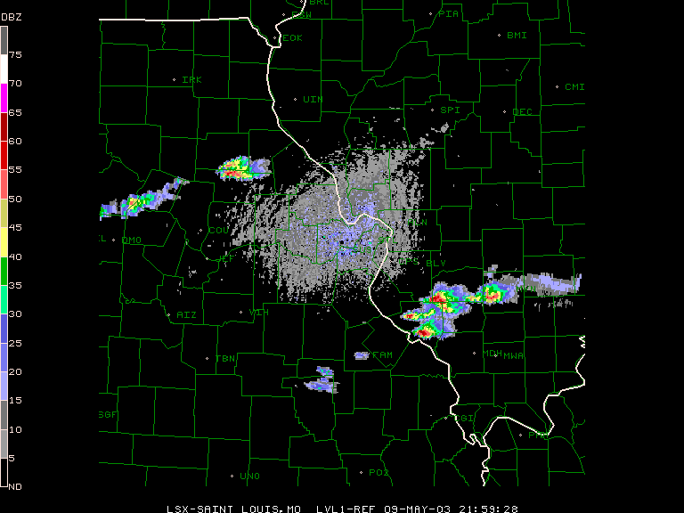
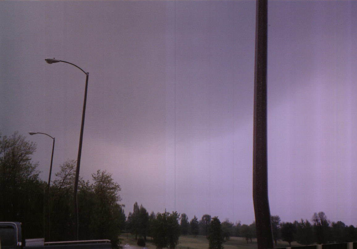
From Chester, the only road options are NW or SE on route 3, or back NE on 150 which would take me right back nto the hail core. I decided the best tactic was to drop SE the pick up a N route about 12 miles SE of Chester (it seemed like more, especially when I heard the storm had weakened and the warning was cancelled 5 minutes early). As I headed back north on 151 to pick up 4 at AVA, I noticed another hard updraft to my NW. Though I thought it might be the storm I had been on, it was another one farther north and a little west. It was looking very good and soon was SVR warned. SVR was issued at 5:50 based on report of golfballs in Counterville. I caught up to it in western Perry Co. and watched it a while, but it showed no signs of lowerings or any visible rotation, so I kind of gave up on it and headed north. Here is a radar image of the storm from around 6:00 p.m. It looks quite impressive on radar; frankly more so than it did in person. When I got to route 13 at Coulterville a new updraft was forming to the SW. I had kind of given up at this point, but it appeared to intensify as I stopped to snap a couple pics of the impressive updraft towers from Tilden. I decided to go after it again, and stopped to watch it a few miles southeast of Coulterville. It appeared to have two strong updrafts, N and S of route 13, but again no lowerings and no discernable rotation. Around 6:45 I gave up on it and headed home.
Lessons learned:
1. There are places in Illinois that are just as hilly and forested as MO - especially near the Mississippi River in the southern part of the state.
2. The cool air, gunge, and haze are not always north of the boundary.
3. If you have two boundaries within chasable distance, the first one on which storms fire is not always the best. For the most part, the storms to the north along the frontal boundary turned out to be better, though not dramatically so.
Total chase distance: 210 miles.