Ingolf Vogeler, Types of
International Borders
along the U.S.-Mexico Border
![]() Fenced
and Walled Borders: Iron Curtain
Fenced
and Walled Borders: Iron Curtain
International fenced and walled borders are illustrated with two strikingly dissimilar and yet similar borders: the Iron Curtain in Europe during the Cold War and the Israel-Palestine Walls.
Whereas the Iron Curtain and the Berlin Wall kept East Germans and East Berliners within East Germany, the Israel-Palestine Walls keeps Palestinians out of Israel. Although the former walled border kept people in and the later border keeps people out, these severely fortified borders function(ed) as “security” landscapes of exclusion for both states. The Israel Walls are particularly ironic because Israel complained that the Soviet Union prevented Jews from leaving and immigrating to Israel, yet Israel does not support the free movement of Palestinians to return to their homeland in what is now Israel.
After World War II the disagreements in power sharing between the Allies
resulted in the emergence of the Cold War. In response to the NATO pact
among the Western Allies, the Warsaw Pact countries gradually closed off
their borders to the West. The "Iron Curtain," as British Prime Minister
Winston Churchill called it, became the most heavily militarized zone in
world history, particularly between the two Germanys and the division of
Berlin.
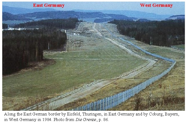
From 1945-1951 the
German-German border was fairly easy to cross: most of the border was
open or had very low wire fences. Starting in 1952, the East German
government declared a closed border zone and cross-border traffic was
restricted and difficult. This border was fortified with taller wire
fences and border security installations. According to Lenz, by
1961,"the border was strengthened and guarded more than any other
political frontier in the democratic world" (Lenz 1983: 250).
Nevertheless, only in Berlin and a few villages on the border were walls
ever constructed. Winston Churchill’s description of this international
border as “The Iron Curtain” was dramatically inaccurate.
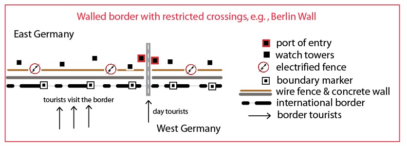
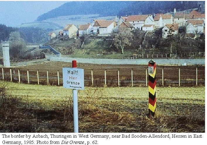
Concrete walls, "no-man's land," watch towers, and border fences were also used to separate farm villages (in the photo below, near Bad Sooden-Allendord in Hessen) from West Germany. The stripped gold-black-red cement border marker indicated the line of the international border. The "Halt. Hier Grenze" sign was on the West German side of the border.
The East German border consisted of
black-red-gold cement markers, warning signs, 500-meter wide cleared
strip in front of wire fence, 80-cm deep ditch, concrete-slab roadway,
watch towers, lights, concrete walls around villages and in Berlin,
another wire fence (commonly electrified), and check points within 5 km
of the border zone. Border patrols were housed in nearby barracks. East
German and the Warsaw Pact and West German and NATO military units were
stationed in nearby cities, respectively, on either side of this border.
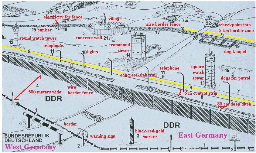
Source for the Iron Curtain diagram: Ingolf Vogeler, "The Relic Landscape of the Iron Curtain in Germany, Geography Online, Volume 1, Number 1, Spring 2000.